


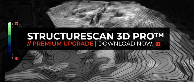
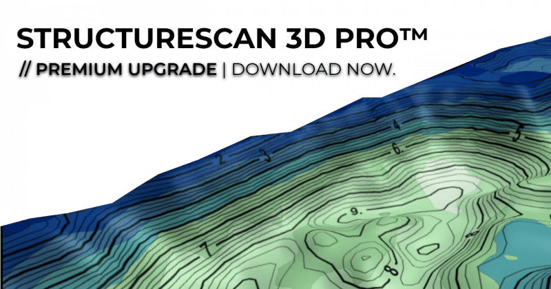
STRUCTURESCAN 3D PRO | PREMIUM APP UPGRADE! - NOW ONLINE!
World first for baitboats and industrial rovers - our fully integrated 3D Structure Mapping Pro.
Auf der Suche nach harten oder kiesigen Spots?
Sorge, dein Rig im Schlamm zu versenken?
Kein anderes Funk- Echolot bietet Anglern und Industriekunden eine derart hochauflösende, intuitive und vorallem übersichtliche live Anzeige der Gewässertiefe und Bodenstruktur!
Neben der genauen Tiefe ist die Bodenstruktur und Bodenhärte der wichtigste Faktor für eine präzise Spotauswahl!
" Nie zuvor war es möglich einen so genauen Überblick über die Bodenbeschaffenheit zu bekommen und damit schlammfreie Hotspots zu finden wie mit dem neuen Structurescan von Carplounge!
Und das alles direkt und live in der App ohne externe Programme wie Reefmaster nutzen zu müssen. "
- Ali Hamidi
Looking for hard or gravelly spots?
Worried about your rig sinking in the mud?
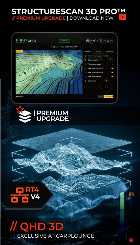
STRUCTURESCAN 3D PRO™ - the absolute top class in the high-end range!
No other wireless echo sounder offers anglers and industry customers such a high-resolution, intuitive and, above all, clear live display of water depth and bottom structure!
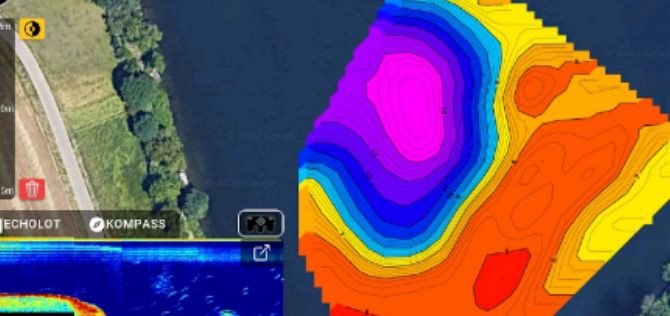
Besides the exact depth, the NEW STRUCTURESCAN 3D PRO™ feature reveals the bottom hardness levels of the mapped area and will be the most important factor for a precise spot selection!
" It has never been possible before to get such a precise overview of the bottom composition. Easily find mud-free hotspots with the New Structurescan 3D Pro™ feature from Carplounge!
And all of this directly and live in the app without having to use an PC and external programs such as Reefmaster. "
-Ali Hamidi
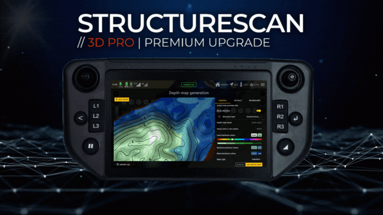
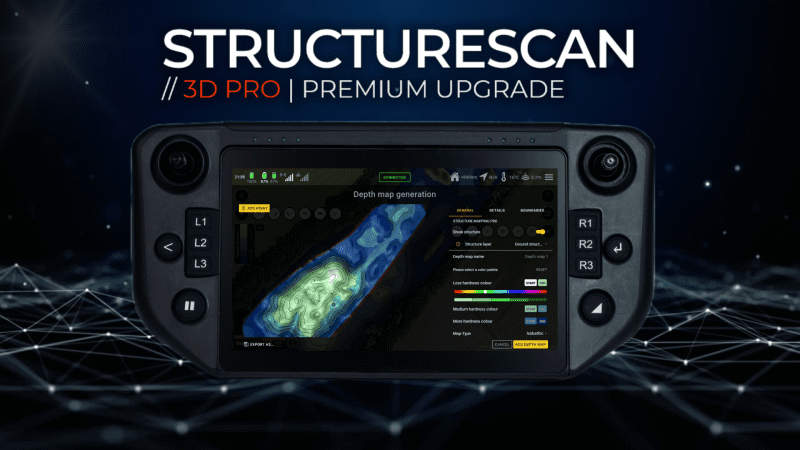
STRUCTURESCAN 3D PRO™ | DETAILS
Structure Map Overlay as an industry standard!
While so far "only" pure 3D depth maps could be generated with the Carplounge 3D Mapping feature, but from now on we are using the full bandwidth of 7CH Element QHD Transducer to collect the ultra high resolution bottom structure data for the New Structurescan 3D Pro™ feature. In addition to the depth data, two additional data layers will be recorded with the Structurescan 3D Pro™ Upgrade to display the structure and hardness of the bottom in 3 Dimensional in their own layers:
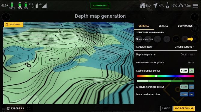
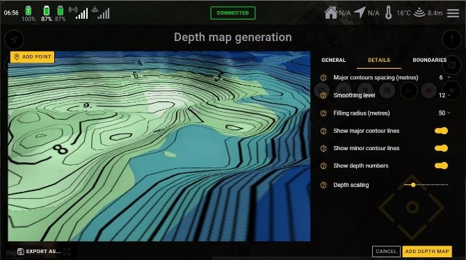
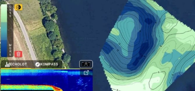
Structure layer - bottom surface : The first echo that is reflected from the bottom (and typically has the highest reflectivity) is used to generate the map.
Structure layer - bottom structure: Here, in addition to the first echo, 10% of the further bottom/surface data is also used for the generation of the map.
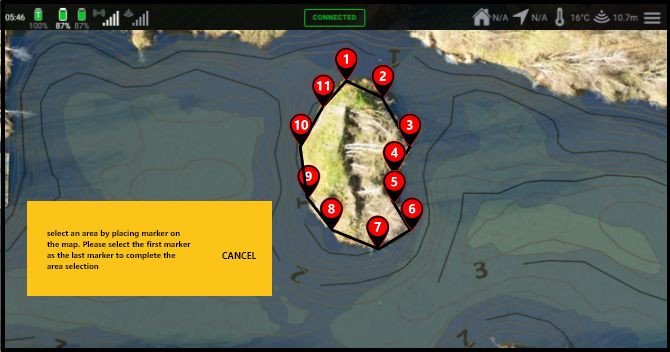
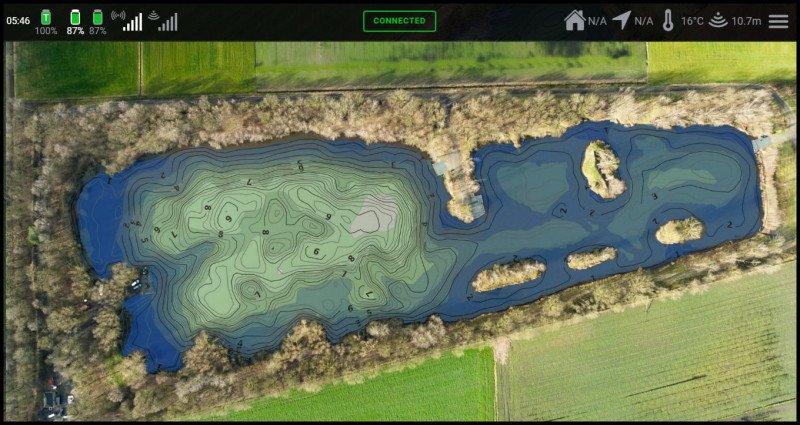
MAP BOUNDARY MANAGEMENT | ISLANDS & SHORELINES
Map boundaries are polygons that can be added to a map to define the shoreline and islands of the mapped area.
These defined polygons contains zero depths and together with the collected mapping data it ensures optimized interpolation to generate detailed depth & structure maps to view in 3D / 2D or use as an overlay on top of the Google Earth background in the Carplounge app. This gives the best map overview and prevents all unwanted display errors!
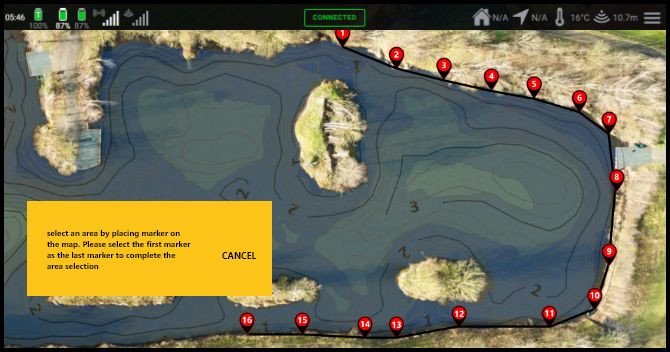
Shore & zero lines
By simply tapping on the map, you can now directly mark the course of the shore on the map to create a defined " shore line with zero depths", Just like professional external applications such as Reefmaster.
Islands and Others Areas
Just like shorelines, islands and other areas of the mapped area can now be marked and can specifically excluded from the map.
Exclusively mark shorelines and add exclusions - such as islands - to the map generation. And all of this directly and live in the app without having to use external programmes like Reefmaster.
NEW ICON FOR QUICK MAP & OVERLAY SELECTION
Through the digital connection with our autopilot V4, the depth & structure data are directly and graphically processed in the V4 app. With the structure mapping update, a new icon is available that can be used to easily switch between structure and depth maps while driving!
Switch live between the different views to optimally identify fish, bottom structure and bottom hardness according to your preference and situation.
Our V4 apps are constantly being developed. Our customers can download the latest version of the most important and useful enhancements from the Playstore free of charge via an app update.
PREMIUM APP UPGRADES
Extremely complex features such as REALVISION or STRUCTURE MAPPING PRO, which take hundreds of hours in development time, can be ordered directly from our website for an extra fee or purchased as an upgrade at a later date.
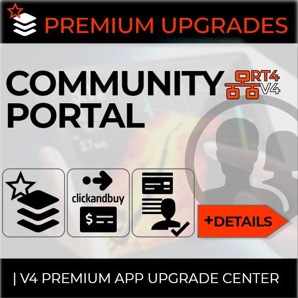
PREMIUM UPGRADES | UNLOCKING
From the December update onwards, our community portal will be available in the app. To activate premium apps, our customers can log into the community portal with your carplounge.de / carplounge.co.uk web shop account name and password. After logging in with the valid email address and password, paid premium app upgrades are activated, they are installed automatically and are then available directly in the app.

Our Sales & Service Managers Daniel and Philipp explain the difference, tips & tricks and point... [more]

"It's not just in cold water that finding the fish is the key to being effective. 50 metres might... [more]

Henk Suylen Proline - Baitspirals “With the baitspirals carplounge offers its customers an... [more]

''After extensive discussions with other baitboat owners it was clear to me quickly that it must... [more]

”This is the latest addition to our Monster carp team. The Carp Lounge RT4 boat! Globally... [more]

Longrange specialist Frank picked up his RT4 Baitboat at the BigOne Carp show and tells us in an... [more]

'' It was amazing how quick it was to master the controls but getting used to the speed of this... [more]

‘’ It’s a new lake, you can learn a lot by driving around with the baitboat by using the... [more]

The same evening we got a enthusiastic call from Samir: ‘’I already got some nice carps and I’m... [more]

'' The heads of Fox int. and Korda Developments: // in action with their RT4 Raymarine Autopilot... [more]